How Does an Online Altimeter Work?
Our web-based altimeter utilizes the HTML5 Geolocation API to securely access your device's internal GPS receiver. By communicating with a constellation of satellites orbiting the Earth, your device can calculate its precise position in 3D space, providing you with your elevation above mean sea level.

Why is My Elevation Showing as "N/A"?
If the altimeter is blank or showing "N/A", your device currently lacks a 3D GPS Fix. Standard 2D location (latitude and longitude) only requires signals from 3 satellites.
However, calculating altitude requires a clear, unobstructed line of sight to a minimum of 4 GPS satellites. Because of this, GPS altimeters rarely work indoors, underground, or in dense urban canyons.
GPS Altimeter vs. Barometric Altimeter
It is important to understand the difference between how this tool works and how specialized hiking watches function.
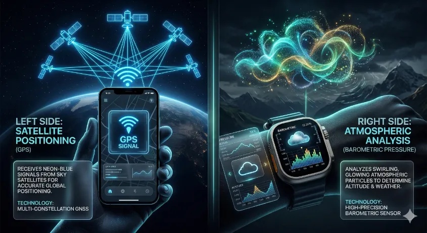
- GPS Altitude (This Tool): Uses satellite geometry. It is highly accurate outdoors but can fluctuate by 10-20 meters depending on satellite positioning.
- Barometric Altitude: Uses a physical hardware sensor to measure air pressure. While smoother, it requires constant manual calibration.
Tips for Maximum Elevation Accuracy
To get the most precise reading, step outside into an open area with a clear view of the sky. Hold your device steady and wait 30 to 60 seconds.
Altimeter Frequently Asked Questions
Do I need an internet connection to use this?
While an internet connection helps load the page, the actual altitude calculation relies purely on passive radio signals from GPS satellites.
Can I use this on an airplane?
Usually, no. Commercial airplane cabins are heavily shielded, blocking weak GPS signals from reaching your phone.